Holyhead Coastal Hike, Anglesey (19 km)
A 19 km loop from Holyhead over the shoulder of Holyhead Mountain, along the clifftop above South Stack, and back inland from Porth Dafarch.
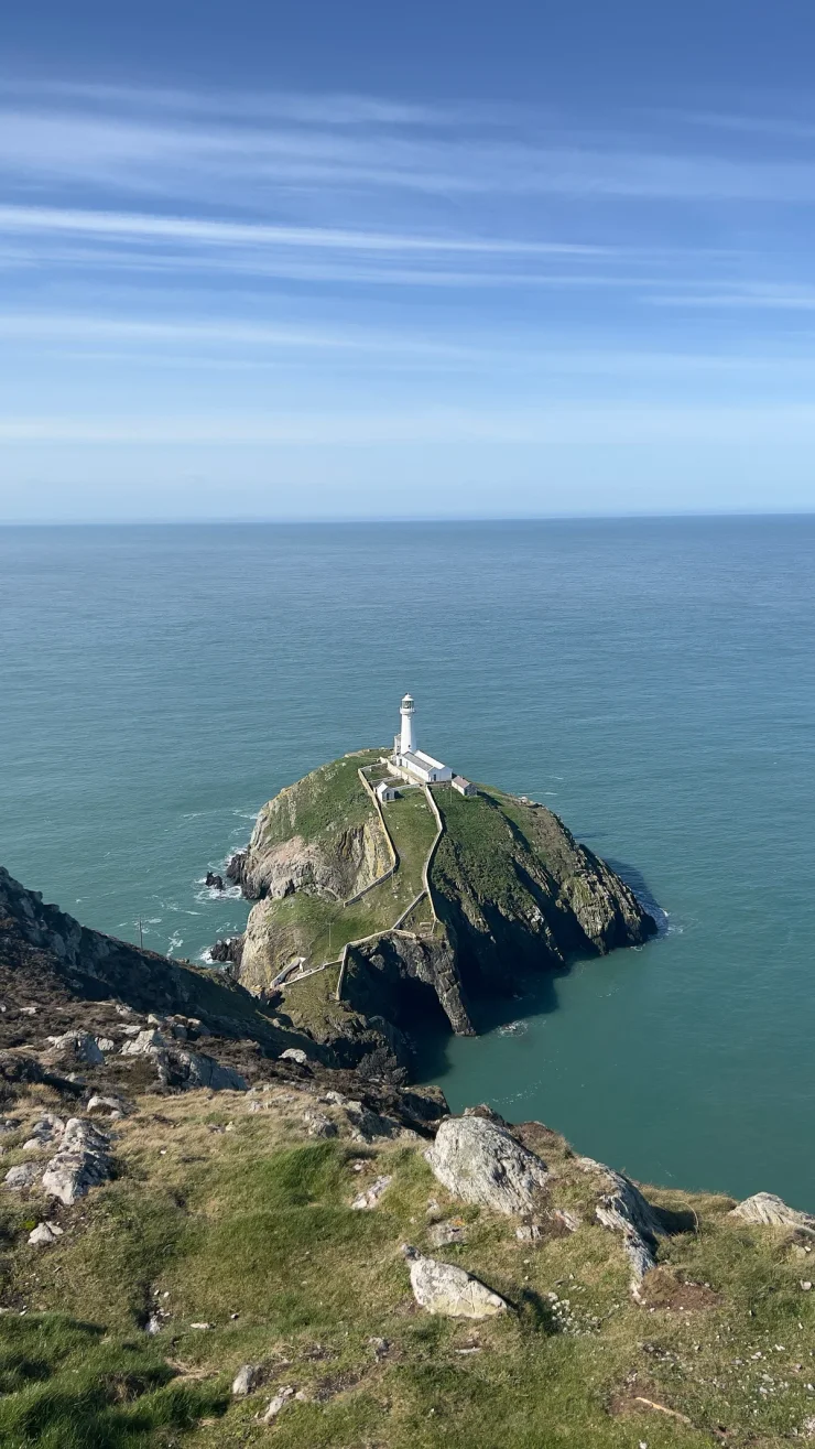
Holyhead is a ferry port on Holy Island, at the western edge of Anglesey in north Wales. This 19 km loop leaves Newry Beach, climbs the northern shoulder of Holyhead Mountain, follows the clifftop above South Stack and turns inland beyond Porth Dafarch. About 15 of those kilometres run on the Isle of Anglesey Coastal Path. On the same coast, the Great Orme walk at Llandudno is shorter and just as exposed; further south, St Davids covers the Pembrokeshire coast path.
The Holyhead loop
There is one sustained climb, from Breakwater Country Park up onto Holyhead Mountain, and the rest of the ascent arrives in small pieces along the cliffs.
Wales - Holyhead
Wales - Holyhead
- 19 km
- 490 m
- 177 m
Works in Komoot, AllTrails, Garmin & most hiking apps.
- Start and finish: Newry Beach, on the Holyhead seafront
- Distance: about 19 km (12 miles)
- Ascent: roughly 490 m, only 180 m of it in one piece
- Terrain: clifftop paths and rocky moorland, with tarmac at both ends and a kilometre of South Stack Road in the middle
Onto Holyhead Mountain
The tarmac gives out after a kilometre and a half, and the path runs on to Breakwater Country Park, the quarry that produced stone for Holyhead’s breakwater between 1846 and 1873. From there the climbing starts, and the route tops out at 177 metres beside the Holyhead telegraph station, part of the Liverpool and Holyhead Telegraph, rebuilt in 1841 and standing today as a ruined walled complex.
The 220-metre summit sits above the route rather than on it, and so does Caer y Twr, the Iron Age hillfort walled around it. Cadw grades the ground up there as strenuous, which is fair warning for anyone tempted by the detour.
South Stack
The cliffs open out at South Stack, where the route passes the car park and Ellin’s Tower, a Victorian building on the clifftop, then traces the edge of the RSPB reserve. Guillemots, razorbills and puffins breed on the rock below in spring, and choughs are on this coast all year.
The lighthouse is 400 steps below, on its own island — Trinity House built it in 1809 — and this circuit stays above it.
Down the coast to Porth Dafarch
South Stack Road takes over for about a kilometre. The Holyhead Mountain hut circles sit a hundred metres off it: around twenty of an estimated fifty prehistoric buildings, surviving mostly as circular hut foundations. The Isle of Anglesey Coastal Path then resumes and runs five kilometres south, past Penrhyn Mawr and a string of small bays, to the sand at Porth Dafarch.
Past Porth Dafarch the route leaves the sea for good. A lane and a chain of public footpaths cut back north-east across the island, and the last two kilometres are Holyhead streets, passing the third-century walls of Caer Gybi — four metres high in places, and, Cadw suggests, part of the same late Roman defence as the watchtower at Caer y Twr.
Arriving in Holyhead
The railway station and the ferry terminal for Ireland are both under a kilometre from the start, so this one works without a car. There are pay-and-display car parks at Breakwater Country Park and at South Stack.
The RSPB calls the coastal trail through its reserve rugged, uneven and narrow, and the heathland it crosses gives no shade at all.
References
- Isle of Anglesey Coastal Path route overview
- Holyhead Breakwater Country Park, council information
- Holyhead Telegraph Station, Coflein site record
- Cadw guide to Caer y Twr Roman watchtower
- Cadw guide to Caer Gybi Roman fort
- Cadw guide to Holyhead Mountain prehistoric village
- South Stack Lighthouse, Trinity House record
- South Stack visitor centre, Trinity House information
- RSPB South Stack nature reserve